Tag: half century cycle

WOW! That’s me another year older!

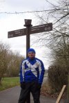
WOW! That’s me another year older! That’s me just turned 41, feels like only yesterday I was 40! Where do the years go?!??! So for my birthday, went a mini cycle! Did my 5th, half century cycle of the year!

Check out the route at www.strava.com/activities/4128752319, also give me a follow at www.strava.com/athletes/gsvalentine.

Myself at Elton and Orston railway station

Myself at Elton and Orston railway station

First half century cycle of 2020!

So pleased with myself, just done my first half century cycle of 2020! So in other words 50 miles! Not just 50 kilometres (31 miles), that most of Europe does! Now I really need to aim for 80 miles next! Then really, really hoping, I can get a 100 mile cycle in before the year is out!

You can check out the route at www.strava.com/activities/3833873559

Hunter inline skinsuit Team Britain 2018

Hunter inline skinsuit Team Britain 2018

Hunter inline skinsuit Team Britain 2018

24-Mar-2014 : First half century (50 miles) cycle of 2015

At long last done my first 50 mile cycle of 2015! Hope it’s the first of many! But I don’t think, I will meet a HOT lad dressed in Lycra again, that wanted to try out Amazing Spiderman 2 Morphsuit. Photos to follow!! 😀

I will now leave you with the route map, elevation graph and route statistics.

Route map:-

24-03-2015 - bike ride route map

Elevation graph:-

24-03-2015 - bike ride elevation graph

Route statistics:-

  • Start time: 12:16 pm.
  • Distance: 50.54 miles.
  • Time: 4:17:12 (h:m:s).
  • Elapsed Time: 6:28:18 (h:m:s).
  • Avg Speed: 11.8 mph.
  • Max Speed: 32.2 mph.
  • Elevation Gain: 466 meters.
  • Min Elevation: 58 meters.
  • Max Elevation: 143 meters.

Data from: Garmin Connect.

17-Apr-2014 : Second half century (50 miles) cycle of April

That’s me just done my second 50 mile cycle in so many days! So since Monday (14th April) I have now done 157.27 miles. So at long last, I am fast starting the get the miles in! Till got a long way to go, to reach goal for the month.

I will now leave you with the route map and route statistics. Sorry no elevation data. GPS was playing up yet again! Said my min elevation was -8 metres. So don’t believe that for one second!

Route map:-

17-04-2014 bike ride

Route statistics:-

  • Start time: 11:22 am.
  • Distance: 52.31 miles.
  • Time: 4:12:25 (h:m:s).
  • Elapsed Time: 5:17:42 (h:m:s).
  • Avg Speed: 12.4 mph.
  • Max Speed: 33.8 mph.
  • Elevation Gain: No data.
  • Min Elevation: No data.
  • Max Elevation: No data.

Data from: Garmin Connect.

15-Apr-2014 : First half century (50 miles) of April 2014

Just done my first half century (50 miles) cycle of the month. Which normally, I would be very happy with. But till now the longest cycle of the month has only been 35.64 miles. So need to do a good number more 50+ cycle this month, to get my total up!

I will now leave you with the route map, elevation graph and route statistics.

Route map:-

15-04-2014 bike ride

Elevation graph:-

15-04-2014 bike ride elevation graph

Route statistics:-

  • Start time: 11:54 am.
  • Distance: 50.81 miles.
  • Time: 3:55:13 (h:m:s).
  • Elapsed Time: 5:00:28 (h:m:s).
  • Avg Speed: 13 mph.
  • Max Speed: 29.2 mph.
  • Elevation Gain: 517 meters.
  • Min Elevation: 41 meters.
  • Max Elevation: 162 meters.

Data from: Garmin Connect.

19-Mar-2013 : Second 50+ mile cycle of the year

Today I did, what is only my second 50+ mile cycle of the year. I did not even mean to. I was hoping just to cycle to Oakham via Stamford and Rutland Water and back. But since it turned out to be a very nice day. I ended up cycling out of Oakham along National Cycle Network Route 63 and covered miles and miles of road I never ever been on before. Most of the time I had not idea where I was at all. It ended up being a great cycle. I will sure head out that way again!

I will now leave you with the route map, elevation graph, route statistics and photos.

Route map:-

19-03-2013 bike ride

The dark blue section of the route, shows new roads I covered during the cycle.

Elevation graph:

19-03-2013 bike ride elevation graph

Route statistics:-

  • Distance: 51.21 miles.
  • Time: 4:06:55 (h:m:s).
  • Avg Speed: 12.4 mph.
  • Max Speed: 29.9 mph.
  • Elevation Gain: 869 meters.
  • Min Elevation: 27 meters.
  • Max Elevation: 204 meters.

Data from: Garmin Connect.

Photos from the cycle:-
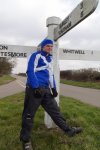
Oakham Road / Exton RoadCold Overton Road / Oakham Road / The CarriagewayUnnamed Road (NCR 64)Unnamed Road (NCR 64)Rutland Water cycle route sign post

26-Feb-2013 : First half century (50 miles) cycle of the year

Well pleased with myself. Just done my first half century (50 miles) cycle of the year. I was not planning to when I set off. But someone twitter give me the idea! I was going to be happy with 40 miles. Pleased I did it, means I have beating the longest cycle I did in February last year. Which was 44.28 miles.

I will now leave you with the route map and route statistics. No elevation graph like normal due to the GPS playing up.

Route map:-

26-02-2013 bike ride

Route statistics:-

  • Distance: 50.13 miles.
  • Time: 4:03:18 (h:m:s).
  • Avg Speed: 12.4 mph.
  • Max Speed: 28.3 mph.

No Elevation data, due to GPS playing up.

Data from: Garmin Connect.