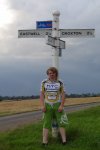
I am so pleased with myself. I have just done, my second 100+ mile cycle ever!! The last time I did 100+ miles was back in September last year. Check out the post: First ever 100 mile bike ride to see the route I took then.
Lucky I planned the route in my head this time. So did not have to mini cycle around my village to get the miles up. Also really liked this road, covered lots of new roads. So glad I had a OS map with me, to stop myself from getting lost.
I will now leave you with the route map, elevation graph, route statistics and photos.

The dark blue section of the route, shows new roads I covered during the cycle.
Elevation graph:

Route statistics:-
- Distance: 101.61 miles
- Time: 8:01:12 (h:m:s)
- Avg Speed: 12.7 mph
- Max Speed: 30.1 mph
- Elevation Gain: 882 meters
- Min Elevation: 4 meters
- Max Elevation: 179 meters
Data from: Garmin Connect — connect.garmin.com/modern/activity/213419058.
Photos from the cycle:-


