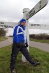
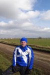
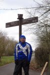
Happy days, just done my first half century ride of 2018. Ended up doing 52.08 miles. Filmed this vlog during the last 10 miles.
First Half Century Ride of 2018 ✅
That’s me just done the first half century ride of 2018! So well pleased, I ended up doing 52.08 miles! Let’s just hope, it’s the first of many this year and that I can also get in a full century ride, at some point this year…
You can check out the route, I took over at www.strava.com/activities/1547850637
24-Mar-2014 : First half century (50 miles) cycle of 2015
At long last done my first 50 mile cycle of 2015! Hope it’s the first of many! But I don’t think, I will meet a HOT lad dressed in Lycra again, that wanted to try out Amazing Spiderman 2 Morphsuit. Photos to follow!! 😀
I will now leave you with the route map, elevation graph and route statistics.
Route map:-

Elevation graph:-

Route statistics:-
- Start time: 12:16 pm.
- Distance: 50.54 miles.
- Time: 4:17:12 (h:m:s).
- Elapsed Time: 6:28:18 (h:m:s).
- Avg Speed: 11.8 mph.
- Max Speed: 32.2 mph.
- Elevation Gain: 466 meters.
- Min Elevation: 58 meters.
- Max Elevation: 143 meters.
Data from: Garmin Connect.
17-Apr-2014 : Second half century (50 miles) cycle of April
That’s me just done my second 50 mile cycle in so many days! So since Monday (14th April) I have now done 157.27 miles. So at long last, I am fast starting the get the miles in! Till got a long way to go, to reach goal for the month.
I will now leave you with the route map and route statistics. Sorry no elevation data. GPS was playing up yet again! Said my min elevation was -8 metres. So don’t believe that for one second!
Route map:-
Route statistics:-
- Start time: 11:22 am.
- Distance: 52.31 miles.
- Time: 4:12:25 (h:m:s).
- Elapsed Time: 5:17:42 (h:m:s).
- Avg Speed: 12.4 mph.
- Max Speed: 33.8 mph.
- Elevation Gain: No data.
- Min Elevation: No data.
- Max Elevation: No data.
Data from: Garmin Connect.
15-Apr-2014 : First half century (50 miles) of April 2014
Just done my first half century (50 miles) cycle of the month. Which normally, I would be very happy with. But till now the longest cycle of the month has only been 35.64 miles. So need to do a good number more 50+ cycle this month, to get my total up!
I will now leave you with the route map, elevation graph and route statistics.
Route map:-

Elevation graph:-

Route statistics:-
- Start time: 11:54 am.
- Distance: 50.81 miles.
- Time: 3:55:13 (h:m:s).
- Elapsed Time: 5:00:28 (h:m:s).
- Avg Speed: 13 mph.
- Max Speed: 29.2 mph.
- Elevation Gain: 517 meters.
- Min Elevation: 41 meters.
- Max Elevation: 162 meters.
Data from: Garmin Connect.
19-Mar-2013 : Second 50+ mile cycle of the year
Today I did, what is only my second 50+ mile cycle of the year. I did not even mean to. I was hoping just to cycle to Oakham via Stamford and Rutland Water and back. But since it turned out to be a very nice day. I ended up cycling out of Oakham along National Cycle Network Route 63 and covered miles and miles of road I never ever been on before. Most of the time I had not idea where I was at all. It ended up being a great cycle. I will sure head out that way again!
I will now leave you with the route map, elevation graph, route statistics and photos.
Route map:-

The dark blue section of the route, shows new roads I covered during the cycle.
Elevation graph:–

Route statistics:-
- Distance: 51.21 miles.
- Time: 4:06:55 (h:m:s).
- Avg Speed: 12.4 mph.
- Max Speed: 29.9 mph.
- Elevation Gain: 869 meters.
- Min Elevation: 27 meters.
- Max Elevation: 204 meters.
Data from: Garmin Connect.
Photos from the cycle:-
26-Feb-2013 : First half century (50 miles) cycle of the year
Well pleased with myself. Just done my first half century (50 miles) cycle of the year. I was not planning to when I set off. But someone twitter give me the idea! I was going to be happy with 40 miles. Pleased I did it, means I have beating the longest cycle I did in February last year. Which was 44.28 miles.
I will now leave you with the route map and route statistics. No elevation graph like normal due to the GPS playing up.
Route map:-

Route statistics:-
- Distance: 50.13 miles.
- Time: 4:03:18 (h:m:s).
- Avg Speed: 12.4 mph.
- Max Speed: 28.3 mph.
No Elevation data, due to GPS playing up.
Data from: Garmin Connect.


