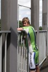
That was a good cycle! Even found a new road, I’ve always past and never noticed it before! I only did 30 miles, I was hoping to do more. But had to get back to pick a mate up from the train station.
So far this year, I’ve only done 1,056.8 miles. By this time last year, it was 2,730.5. So I am 1,673.7 miles down! On the same point last year! Can’t see me making them number of miles up, before the end of the year! 🙁
I will now leave you with the route map, route statistics and photos.
Route map:-

Elevation graph:-

Route statistics:-
- Start time: 12:59 pm.
- Distance: 30.45 miles.
- Time: 2:25:02 (h:m:s).
- Elapsed Time: 3:16:44 (h:m:s).
- Avg Speed: 12.6 mph.
- Max Speed: 38.7 mph.
- Elevation Gain: 320 meters.
- Min Elevation: 55 meters.
- Max Elevation: 136 meters.
Data from: Garmin Connect.
Photos from the cycle:-


