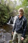
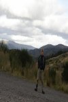
I am well happy, since when I first come to Scotland last week the weather was a not very good at all. But lucky since then we have had two OK days, weather wise. When I mean OK, it did not rain. So I really wanted to make the most of it. So I made it out on the bike again. This time I cycled from Killearn to Aberfoyle then up and over the Duke’s Pass.
Just to give you an idea of what it’s like here is a video of someone else doing it, but using a motorbike.
While you watch the video. I will tell you a bit more about the route. I set off from Killearn at 12:44pm, following the A875 towards Balfron, turning left just before Boquhan, where the road goes down hill very fast then over the River Endrick. Where I stopped to take the first photos (Old road bridge near Boquhan and New road bridge near Boquhan) during the cycle. Then I stayed on that road till it meets up with the A81 at Balfron Station. Then I tuned left, towards the Ballat Crossroads where I stopped to take more photos.
I stayed on that road, till Cobleland, yes that’s really a place name. Not really much there, just a Caravan & Camping site, some houses and the bit I cared about. The access to the National Cycle Network, route number 7. It was time to stop, yes again and take some more photos. I stayed one this very, nice flat section to Aberfoyle.
This is where the fun really started. Since I had the fun of cycling from around sea level (Well if the Garmin connect website is to be believed. I need to look out a local OS map and double check that one). To 238 metres, which does sound about right. This section of the route was not only hard doing since it meant a lot of cycling, it was also off all road using Forestry Commission tracks, which also doubles up has the National Cycle Network, route number 7.
I following this route till it joined the A821 at the exit of 3 Lochs Forest Drive. Then I turned left and had the great fun of cycling over the Duke’s Pass. You get some great views from that road. And also the 10% down hill section all the way into Aberfoyle to look forward to.
Then I just about followed the same route I took to Aberfoyle, all the way back to Killearn.
Now I will leave you some photos, route map and statistics from the cycle.
Photos from the Duke’s Pass cycle:-
Route map:-

Elevation graph:-

Route statistics:-
- Distance: 36.39 miles
- Time: 3:03:48 (h:m:s)
- Avg Speed: 11.9 mph
- Max Speed: 26.9 mph
- Elevation Gain: 697 meters
- Max Elevation: 238 meters
Data from: Garmin Connect.


Awesome G… I kept looking at steetview maps to follow your route! Very nice part of the country… makes me want to try out Dukes Pass myself, but I would be stopping every 50 yards to look at things!
If you ever do it, make sure the schools are NOT off. Also best to do it during the week. As the road can get very busy. So I could not have picked a better day, just about had it all to myself.