I am well happy, since when I first come to Scotland last week the weather was a not very good at all. But lucky since then we have had two OK days, weather wise. When I mean OK, it did not rain. So I really wanted to make the most of it. So I made it out on the bike again. This time I cycled from Killearn to Aberfoyle then up and over the Duke’s Pass.
Just to give you an idea of what it’s like here is a video of someone else doing it, but using a motorbike.
While you watch the video. I will tell you a bit more about the route. I set off from Killearn at 12:44pm, following the A875 towards Balfron, turning left just before Boquhan, where the road goes down hill very fast then over the River Endrick. Where I stopped to take the first photos (Old road bridge near Boquhan and New road bridge near Boquhan) during the cycle. Then I stayed on that road till it meets up with the A81 at Balfron Station. Then I tuned left, towards the Ballat Crossroads where I stopped to take more photos.
I stayed on that road, till Cobleland, yes that’s really a place name. Not really much there, just a Caravan & Camping site, some houses and the bit I cared about. The access to the National Cycle Network, route number 7. It was time to stop, yes again and take some more photos. I stayed one this very, nice flat section to Aberfoyle.
This is where the fun really started. Since I had the fun of cycling from around sea level (Well if the Garmin connect website is to be believed. I need to look out a local OS map and double check that one). To 238 metres, which does sound about right. This section of the route was not only hard doing since it meant a lot of cycling, it was also off all road using Forestry Commission tracks, which also doubles up has the National Cycle Network, route number 7.
I following this route till it joined the A821 at the exit of 3 Lochs Forest Drive. Then I turned left and had the great fun of cycling over the Duke’s Pass. You get some great views from that road. And also the 10% down hill section all the way into Aberfoyle to look forward to.
Then I just about followed the same route I took to Aberfoyle, all the way back to Killearn.
Now I will leave you some photos, route map and statistics from the cycle.
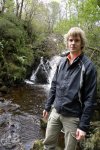
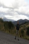
Photos from the Duke’s Pass cycle:-
Route map:-

Elevation graph:-

Route statistics:-
- Distance: 36.39 miles
- Time: 3:03:48 (h:m:s)
- Avg Speed: 11.9 mph
- Max Speed: 26.9 mph
- Elevation Gain: 697 meters
- Max Elevation: 238 meters
Data from: Garmin Connect.


